|
In
this section you will find the translation after each spanish paragraph
and at the bottom of page are the Links to sail the Website
¡
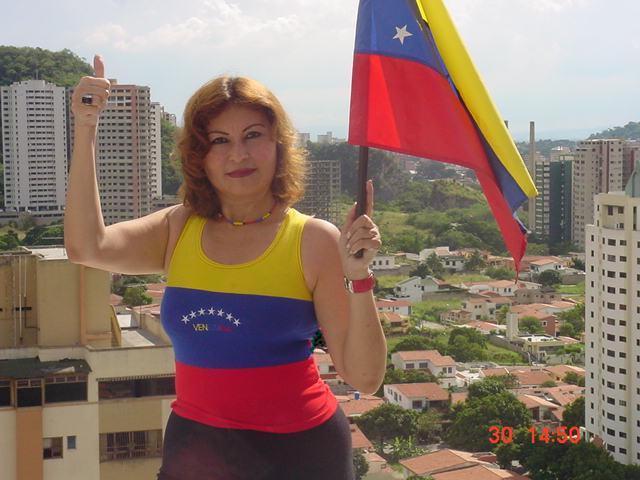
Welcome to Venezuelan !
| Tengo
un sueño, un solo sueño, seguir soñando. Soñar con la libertad soñar
con la justicia soñar con la igualdad y ojalá ya no tuviera necesidad
de soñarlas. Soñar a mis hijos grandes sanos felices volando con sus
alas sin olvidar nunca el nido. Soñar con el amor con amar y ser amado
dando todo sin medirlo recibiendo todo sin pedirlo.
Soñar
con la paz en el mundo en mi país en mi mismo y quién sabe cuál es más
difícil de alcanzar.
Soñar que mis cabellos que ralean y se blanquean no impiden que mi
mente y mi corazón sigan jóvenes y se animen a la aventura, sigan niños
y conserven la capacidad de jugar. Soñar que tendré la fuerza,
la voluntad y el coraje para ayudar a concretar mis sueños en
lugar de pedir por milagros que no merecería. Soñar que cuando llegue
al final podré decir que viví soñando y que mi vida fue un sueño soñado
en una larga y plácida noche de la eternidad.
Martin Luther King
I
have a dream, a single dream, to continue dreaming. To dream about the
freedom to dream about justice to dream about the equality and hopefully
no longer had necessity to dream them. To dream to my happy healthy
great children flying about its wings without never forgetting the nest.
To dream about the love with loving and being loved giving everything
without measuring receiving it everything without requesting it. To
dream about Peace in the world in my country in my same one and who
knows which is more difficult to reach. To dream that my hair that
ralean and whiten they do not prevent that my mind and my heart follow
young people and they are animated to the adventure, they follow
children and conserve the capacity to play. To dream that I will have
the force, the will and the anger to help to make specific my dreams
instead of requesting by miracles that would not deserve. To dream that
when arrives in the end I can say that I lived dreaming and that my life
was a dream dreamed in one long and placid night of eternidad.
Martin Luther King
|
 República Bolivariana de Venezuela
Ubicación:
Norte de América del
Sur
Sout America (North)
Fronteras terrestre: 4.993
km
Borders
: 4.993 Km. |
Superficie total:(Area)
912.050 km²
|
Población: (Population)
22.777.152 habitantes
(Censo 1997) |
|
|
|
... and say No to the violence, and say YES to the Liberty...it´s a
song for Life...it's a song for Liberty...
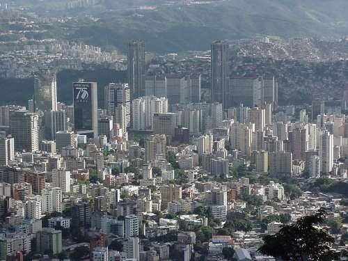
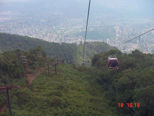
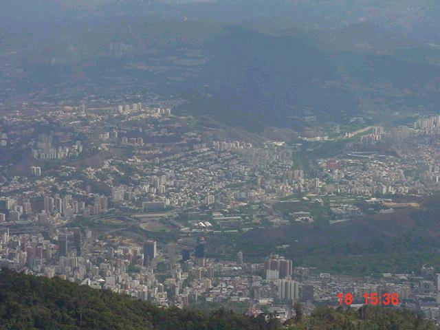
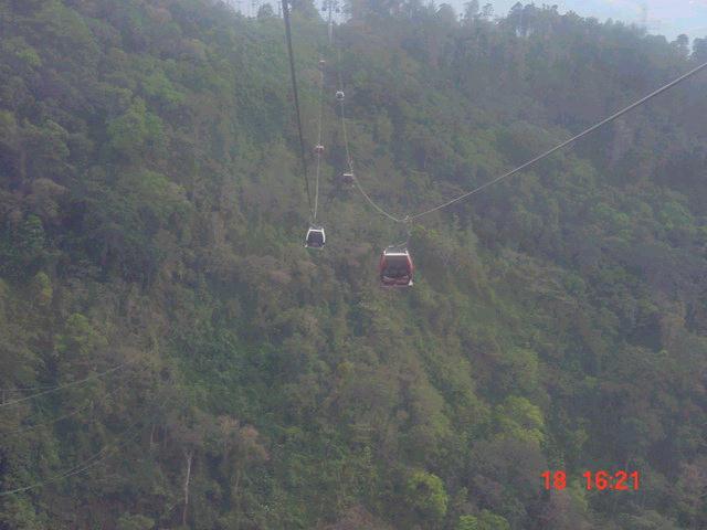
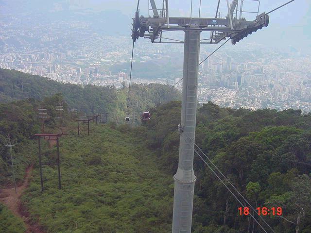
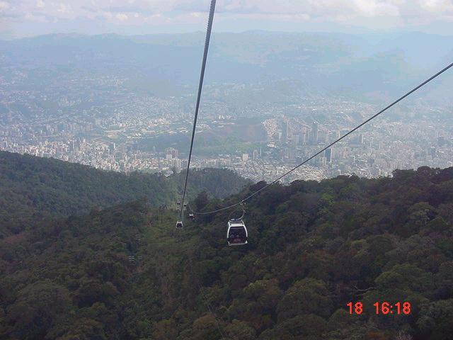
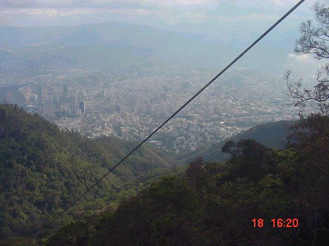
Teleférico de Caracas
_ Parque Nacional El Avila
El Ávila fue decretado Parque Nacional
en 1958. Se encuentra ubicado en el Centro-Norte de Venezuela
dentro del tramo central de la Cordillera de la Costa, con una
superficie de 81.800 Ha y una altura de 2.200 mts sobre el nivel del
mar. Una de las maneras más emocionante de llegar al Ávila es a través
del moderno Teleférico de Caracas, atravesando una distancia de 3.5 km.
en aproximadamente 15 minutos en el recorrido hacia el Parque .
Tiene 74 cabinas, cada una con capacidad para ocho personas. Al
llegar a la estación, los visitantes se pueden divertir en la moderna
pista de patinaje sobre hielo del Hotel Humbolt. Ésta posee 470 m2 de
superficie y cuenta con un moderno sistema de refrigeración, que
mantiene la temperatura a 20° C.
Cableway
of Caracas _ National Park the Avila
The
Avila was
decreed National Park in 1958. One is located in the Center-North of Venezuela
within the central section of the Mountain range of the Coast, with a surface of
81,800. There is and a 2,200 height
of meters on the level of the sea. One of the ways most exciting to arrive at
the Ávila is through the modern Cableway of Caracas, crossing a distance of 3,5
km in approximately 15 minutes in the route towards the Park. It has 74 cabins,
each one with capacity for eight people. When arriving at the station, the
visitors can be amused in the modern track of iceskating of the Humbolt Hotel.
This one has 470 m2 of surface and counts on a modern system of refrigeration,
that maintains the temperature to 20° C.
Imágenes que muestran el recorrido en Teleférico desde Caracas hasta el Parque
Nacional El Avila
Images that show to the route in Cableway from Caracas to the National Park
Avila
Colonia Tovar
Saliendo
de Caracas con dirección al Oeste, aproximadamente a unos 63 km., se encuentra
uno de los
sitios más encantadores de Venezuela, La
Colonia Tovar,
un pedazo de la Selva Negra (Schwarzwald)
del sur-oeste de Alemania,
enclavada en la Cordillera de la Costa, al Norte del Estado Aragua. En
1843
los primeros colonos que llegaron a nuestro
país, provenientes
de pueblos de la Selva Negra, tales
como Wyhl, Edingen y Oberbergen de
Kaiserstuhl se establecieron en estos hermosos parajes.
Durante muchos años
quedaron aislados del resto del país, por lo que las generaciones siguientes
pudieron conservar muchas de sus tradiciones ancestrales, como su lengua, el
badischen (dialecto de
Baden), comidas, vestimentas, bailes, etc. En la
actualidad todos ellos, descendientes de tan
esforzados pioneros, hablan español
y están incorporados totalmente a la realidad nacional.
Tovar
colony
Leaving Caracas in the direction of the West,approximately to
about 63 km, is one of los more
charming sites of Venezuela, The
Colony Tovar, a piece of the Black Forest (Schwarzwald)
of the southwest of Germany, nailed in the Mountain range of the
Coast, to the North of the Aragua State. In the year 1843 first colonos
that arrived at our country, provenientes
of towns of the Black Forest, such as Wyhl, Edingen and Oberbergen de
Kaiserstuhl settled down in these beautiful places.
During many years were isolated of the rest of the country,
reason why the next generations could conserve many of their ancestral traditions, like their
language, badischen (dialecto of Baden), meals, clothes,
dances, etc. At the present time all of them, descending of so
made an effort pioneering, speak Spanish and are built-in totally to the
national reality. |
El Jarillo
EL Jarillo is a small
town next to Tovar Colony
Playas Isla de
Margarita  Beachs of Margarita Island - Venezuelan
Cueva del Guácharo _ Estado
Monagas
| La
Cueva del Guácharo con una superficie de 15.500 hectáreas (10.2 km de largo) es
considerada una de las formaciones cavernarias más interesantes del continente
y la mayor del país.
Fue el primer Monumento Natural decretado en Venezuela en 1947 bajo el nombre
del científico alemán Alejandro Von Humboldt, quien exploro la cueva en 1799
por motivaciones científicas y quien en 1816 dio a conocer la más relevante de
las 1.500 cuevas inventariadas en nuestro país. Posteriormente, en 1975 fue
decretada Parque Nacional cuando se amplió el área de protección con el fin
de preservar su ecosistema, garantizando así los procesos biológicos de la
caverna. Posee una entrada de 23 metros de alto y 28 de ancho, por donde la
mayoría de los turistas que la visitan se atreven a adentrarse sólo hasta los
primeros 1.500 metros donde se pueden apreciar las estalactitas y estalagmitas
formadas por la acción constante del agua sobre la roca.
Cave
of the Guácharo _ Monagas State
Cave of the Guácharo with a surface of 15,500 hectares (10,2
km in length) is considered one of the formation cave more interesting
of the continent and greater one of the country. Alexander was the first
decreed Natural Monument in Venezuela in 1947 under the name of the
German scientist Von Humboldt, who I explored the cave in 1799 by
scientific motivations and that in 1816 he presented most excellent the
1,500 inventoried caves in our country. Later, in 1975 he was decreed to
National Park when the area of protection with the purpose of preserving
its ecosystem was extended, guaranteeing therefore the biological
processes of the cavern. He has an entrance of 23 meters of stop and 28
of wide, by where most of the tourists who visit it they dare to enter
itself only until the first 1,500 meters where the stalactites and
estalagmitas formed by the constant action of the water can be
appreciated on the rock.
|
Teleférico de Mérida _ Pico
Bolívar
|
 El Teleférico
de Mérida es un Sistema de cuatro (4) Teleféricos en serie, que facilita un
desplazamiento
El Teleférico
de Mérida es un Sistema de cuatro (4) Teleféricos en serie, que facilita un
desplazamiento
de 12.5 km para superar el desnivel existente entre la ciudad de
Mérida (1640 m) y Pico Espejo
(4765 m). Es considerado el Teleférico turístico
de montaña más alto y largo del mundo. Desde
la última estación a 4765 m, se pude observar muy de cerca al Pico más alto
en Venezuela,
Pico Bolívar, ( 5007 m)
The
Cableway of Mérida is a System of four (4) Cableways in series, that
facilitates a displacement de 12,5
km to surpass the existing unevenness between the city of Mérida (1640 ms) and
Espejo Tip (4765 ms). The tourist long mountain Cableway is
considered higher and of the world. From the last station to 4765 ms, I could be
observed close by very the highest Tip in Venezuela.
(5007 meters) |
Parque Nacional Canaima
|
El
Parque Nacional Canaima
se encuentra localizado al extremo sur oeste de Venezuela, al sur
del rio Orinoco, en el Estado Bolívar,
siendo decretado Parque Nacional
el 12 de junio de 1962 por el ejecutivo nacional
y
declarado por la Unesco como Patrimonio de la humanidad en el año 1994 .
El
parque, posee 3 millones de Hectáreas,
ocupando de esta
manera la segunda área natural protegida
de mayor extensión en
Venezuela y la séptima en el mundo.
Se
encuentra dividido en dos sectores: Occidental
y Oriental.
El
área occidental llamada Canaima, solo tiene acceso vía aérea
desde Caracas, Margarita y Ciudad Bolívar, encontrándose en este lugar
privilegiado por la naturaleza, el salto de agua mas alto del mundo, el Salto Angel,
con una caída de agua de 970 m. desde el Auyantepui, a 2580 m. sobre el
nivel del mar.
Este salto toma su nombre del apellido de su descubridor, James (Jimmy)
Ángel, aviador estadounidense, el cual lo avistó por primera vez en
1937 cuando sobrevolaba esta zona. El nombre indígena de esta catarata
es el de Churún Merú.
En
el área oriental se encuentra La gran sabana a la cual es posible
desplazarse vía
terrestre y aérea, llegando a Santa Elena de Uairen, ultimo poblado al sur de
Venezuela, a solo 20
minutos en vehículo de la frontera con Brasil.
National
park Canaima
National Park Canaima is located to the South end the west of Venezuela, to
the south of rio Orinoco, in Bolivar
State, being decreed to National Park the 12 of June of 1962 by the executive
national and declared by UNESCO like Patrimony of the humanity in the year 1994
. The park, has 3 million Hectares, occupying this way the second protected
natural area of greater extension in Venezuela and seventh in the world. One is
divided in two sectors: Western and Eastern. The western area called Canaima,
single has aerial access via from Caracas, Daisy and City Bolivar, being in this
place privileged by the nature, the high water jump but of the world,
Salto Angel, with a waterfall of 970 m.s from the Auyantepui, to
2580 m.s on the level of mar. This
jump takes its name from the last name of its discoverer, James (Jimmy) Angel,
American aviator, who sighted it for the first time in 1937 when he flew over
this zone. The indigenous name of this cataract is the one of Churún Merú. In
the Eastern area is the great savannah to which it is possible to move
terrestrial and aerial route, arriving at Santa Elena de Uairen, Iast complete town
to the south of Venezuela, far from 20 minutes in vehicle of the border with
Brazil.
|
 Cañón
del diablo Cañón
del diablo
en el Auyantepui |
 Salto
Ángel Salto
Ángel |
 Formaciones naturales que forman
figuras en el Auyantepui
Formaciones naturales que forman
figuras en el Auyantepui |
Others places
 Observatorio de Mérida Observatorio de Mérida |
 Puerto La cruz
 |
 Médanos de Coro
 |
Santuario Nacional Nuestra Señora de Coromoto.
Este proyecto fue
realizado por el Arq. Erasmo Calvani en el año 1980. Su construcción es
totalmente de concreto de obra limpia. Su altura varia entre 68 y 76 m. En el
sitio de aparición de la Virgen, se construyó una estructura única en el
mundo, llamada doble hiperboloide elíptico, conocida también como cimborio.
Bajo el cimborrio (en la girola) se aprecian los
vitrales, obra del artista Guillermo Márquez, quien desarrolló un sistema
nuevo de montajes en nervios de concreto.
Cuenta con una
construcción de 4.000 m2 de iglesia, 400 mt de Vitrales, 2.000 m2 de cripta y 2.000 m2 entre las
escalinatas y la entrada. Debajo del Santuario está la cripta. Existen allí,
capillas menores, salas de conferencias y museos iconográficos. Las paredes
tienen diferentes alturas, van de los 16 m hasta los 35 m. A la entrada se
destacan dos torres de 75 m de altura, con escalera interna y ascensor que
conducen a un mirador metálico, de donde se puede admirar la llanura. Tiene
capacidad para dos mil quinientas personas cómodamente situadas, un enorme
estacionamiento y áreas verdes alrededor. Su Santidad Juan Pablo II, vino a Venezuela en Febrero
de 1996 a inaugurar y bendecir este Santuario que hace de Portuguesa y su
capital, Guanare, la ciudad Capital Espiritual de Venezuela. obra del artista Guillermo Márquez, quien desarrolló un sistema
nuevo de montajes en nervios de concreto.
Cuenta con una
construcción de 4.000 m2 de iglesia, 400 mt de Vitrales, 2.000 m2 de cripta y 2.000 m2 entre las
escalinatas y la entrada. Debajo del Santuario está la cripta. Existen allí,
capillas menores, salas de conferencias y museos iconográficos. Las paredes
tienen diferentes alturas, van de los 16 m hasta los 35 m. A la entrada se
destacan dos torres de 75 m de altura, con escalera interna y ascensor que
conducen a un mirador metálico, de donde se puede admirar la llanura. Tiene
capacidad para dos mil quinientas personas cómodamente situadas, un enorme
estacionamiento y áreas verdes alrededor. Su Santidad Juan Pablo II, vino a Venezuela en Febrero
de 1996 a inaugurar y bendecir este Santuario que hace de Portuguesa y su
capital, Guanare, la ciudad Capital Espiritual de Venezuela.
National
sanctuary Our Coromoto Virgen.
Project was made by the Arq.
Erasmo Calvani in 1980. Its
construction is totally of concrete of
clean work. Its varia height between 68 and 76 ms. In the site of
appearance of the Virgin, double elliptical hyperboloid was also
constructed to a unique structure in the world, called, well-known like
dome. Under cimborrio (in the girola) the vitrales are appraised, builds
of the artist Guillermo Márquez, who developed a new system of
assemblies in nerves of concrete. Account with a construction of 4,000
m2 of church, 400 TM of Vitrales, 2,000 m2 of cripta and 2,000 m2
between the perrons and the entrance. Underneath the Sanctuary he is
cripta. They exist there, smaller chapels, iconográficos conference
halls and museums. The walls have different heights, go of the 16 ms
until the 35 m.s To the entrance stand out two towers of 75 ms of height,
with internal stairs and elevator that lead to a metallic viewpoint, of
where can be admired the plain. It has capacity for two thousand five
hundred people comfortably located, an enormous parking and green areas
around. Its Sanctity Juan Pablo II, came to Venezuela in February of
1996 to inaugurate and to bless this Sanctuary that for of Portuguese
and its capital, Guanare, the Spiritual Capital city of Venezuela. |
Los LLanos
Una
de las hermosas regiones que posee Venezuela, está conformada por los Llanos,
con extensas sabanas que se pierden en el horizonte. Sus inmensas tierras poseen
una cantidad de ecosistemas que brindan la oportunidad de apreciar una diversa
cantidad de paisajes con rica vegetación y fauna variada. Un paraíso para
quien le guste la naturaleza y de noche quiera admirar una salida de luna y un
cielo estrellado.
One
of the beautiful regions that Venezuela has, is conformed by the Level ones,
with extensive savannahs that are lost in the horizon. Their immense earth have
an amount of ecosystems that offer the opportunity to appreciate a diverse
amount of landscapes with rich vegetation and varied fauna. A paradise for that
it likes at night the nature and wants to admire an exit of moon and a starred sky.
 A
55 Km de la ciudad de Mérida y a 3.140 metros sobre el nivel del mar, se
encuentra San Rafael de Mucuchíes, pueblo donde predomina casas y casonas
de estilo colonial así como antiquísimos molinos de trigo, constituyendo en
conjunto, uno de los tesoros de la Sierra de Santo Domingo. Tiene
583 habitantes, que viven a una temperatura de 9° C aproximadamente, entre un
hermoso paisaje de de páramos, cumbres y lagunas. La imagen muestra La Iglesia de Piedra que se ha convertido en tradición andina. A
55 Km de la ciudad de Mérida y a 3.140 metros sobre el nivel del mar, se
encuentra San Rafael de Mucuchíes, pueblo donde predomina casas y casonas
de estilo colonial así como antiquísimos molinos de trigo, constituyendo en
conjunto, uno de los tesoros de la Sierra de Santo Domingo. Tiene
583 habitantes, que viven a una temperatura de 9° C aproximadamente, entre un
hermoso paisaje de de páramos, cumbres y lagunas. La imagen muestra La Iglesia de Piedra que se ha convertido en tradición andina.
Próximamente
una sección para el estado Carabobo 
 Túnel La Cabrera
 |
 Túnel que separa los Estados Aragua y
Carabobo
Túnel que separa los Estados Aragua y
Carabobo |
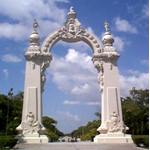
 Entrada al Estado
Carabobo
Capital: Valencia |
Imágenes de la ciudad de Valencia
(norte) _ Venezuela
Images form Valencia City (north)
| Pagina
Inicial | Álbum
Venezuela | Astronomía
| Metafísica
| Poemas | Curiosidades
| Contenido
|
| Home Page |
Astronomy | Metaphysic |
Poems | Curiosity | |


